

-
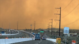 A recent study from the Desert Research Institute offers a detailed look at how wildfire smoke impacts air quality.
 -
 Muchos residentes de Reno nunca recibieron alertas durante el incendio forestal Hawk. Expertos y funcionarios públicos señalan problemas con el software y deficiencias en la infraestructura pública como posibles causas.
 -
 Algunos residentes de Reno afectados por el incendio forestal Hawk dicen que las barreras del idioma y el acceso limitado a información de emergencia hicieron más difícil entender las alertas de evacuación y encontrar ayuda después del incendio.
 -
 Debido a los incendios forestales Bug y Hawk, la Administración de Pequeñas Empresas de Estados Unidos (SBA, por sus siglas en inglés) emitió una declaración de desastre para Nevada el 11 de septiembre.
 -
 El incendio forestal Hawk destruyó 47 viviendas, lo que lo convirtió en el más destructivo de Nevada, según la comisión estatal de seguros. El reciente desastre, junto con otros incendios que ardieron al norte de Reno en agosto, ha reavivado la preocupación sobre el futuro de los seguros de vivienda. Además, una nueva ley estatal abrió la puerta a que las pólizas excluyan por completo la cobertura por incendios forestales, aunque los reguladores estatales aseguran que ninguna aseguradora lo ha hecho hasta ahora.
 -
 Los residentes del vecindario Horizon Hills, al pie de la ladera norte de Peavine y gravemente afectado por el fuego, finalmente pudieron regresar el miércoles por la tarde. Una pareja relató la angustiante experiencia de su evacuación.
 -
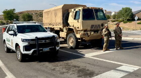 Los equipos de emergencia lograron contener en apenas unos días el incendio forestal Hawk, que arrasó 15.085 acres, a pesar de las condiciones extremas. Los residentes elogiaron esos esfuerzos, pero algunos dicen que las autoridades locales no hicieron lo suficiente para mantenerlos informados.
 -
 Two groups of journalists are asking for a review of communications during the Hawk Fire.
 -
The Hawk Fire destroyed 47 homes, making it the most destructive wildfire in Nevada, according to the state insurance commission. The recent disaster, along with the other fires that burned north of Reno in August, is renewing concerns about the future of homeowners insurance. And a new state law opened the door for policies to completely remove wildfire coverage, although state regulators say no insurers have done so yet.
-
Crews managed to contain the 15,085 acre Hawk Fire in just a few days, in spite of extreme conditions. Residents praised those efforts, but some say local government didn’t do enough to keep them informed.


Editor’s note: KUNR’s live coverage concluded Thursday, Aug. 27, at 11 a.m.