Updated January 29, 2022 at 10:53 PM ET
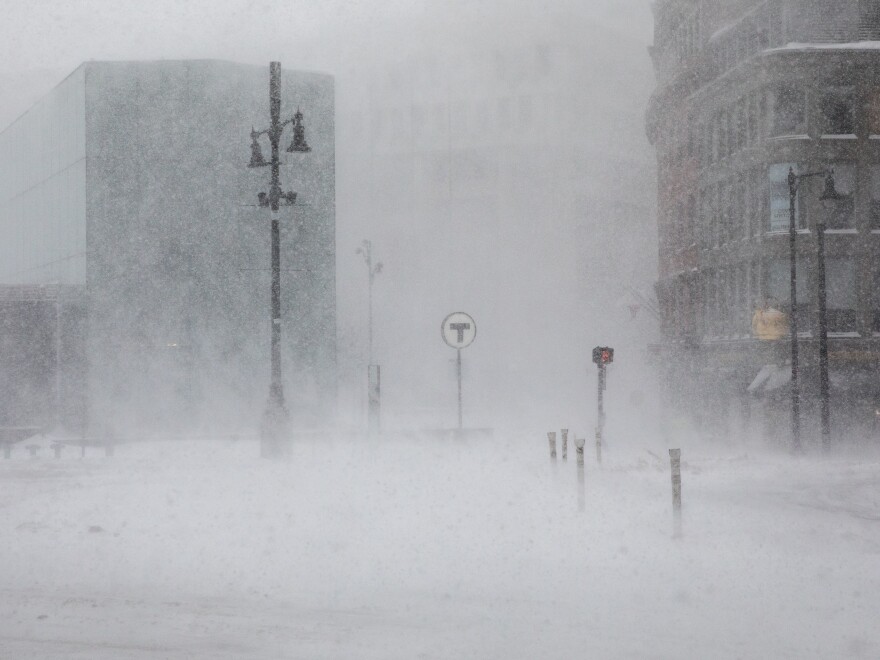
Dangerous blizzard conditions and heavy snow pounded the coastal Northeast U.S. on Saturday, disrupting travel and knocking out power to over 100,000 customers.
By nighttime, with power restored to several regions, total snowfall reached more than 12 inches along most of the Northeast coast and as high as 30 inches in Massachusetts.
Snowfall totals were difficult to calculate because of drifting snow, but reports showed that in some areas of Massachusetts, snow had been falling at a rate of 3 to 4 inches per hour.
In parts of Long Island, the totals exceeded two feet of snow as of 8:30 p.m., with the community of Islip seeing a state high of over 24 inches.
"This is a very serious storm. ... This could be life-threatening," New York Gov. Kathy Hochul said Saturday morning. "We are responding quickly and urgently."


Multiple states measure well over a foot of snow
Other states across the Northeast saw snow totals of a foot or more by afternoon. Observers in Warren, R.I., measured a state high of 24.6 inches. Areas of New Jersey, Delaware and Maryland all measured at least 14 inches or more.
Groton, Conn., measured 21.5 inches. In the state, wind gusts had been more than 60 mph and snow was falling at a rate of 2 to 3 inches per hour.

Blizzard warnings were issued across large swaths of the Northeast coast, but by Saturday afternoon, the National Weather Service's New York office had confirmed that blizzard criteria had been met in two areas: Suffolk County, N.Y., and New London, Conn. The weather service was working to determine whether other regions have also experienced blizzard conditions, which include blowing snow, winds of at least 35 mph and visibility of less than a quarter of a mile for more than three hours.
Flights and trains were canceled across the region
Travel in the region has also been severely disrupted. More than 3,500 flights within, into and out of the United States had been canceled as of Saturday night, according to Flight Aware. About 90% or more of flights out of Boston Logan, LaGuardia and Newark airports were canceled.
And Amtrak trains operating along the East Coast between Washington, D.C., and Boston have been canceled.
The National Weather Service said the storm is a result of "bombogenesis," which occurs when a "midlatitude cyclone rapidly intensifies, dropping at least 24 millibars over 24 hours," according to the National Oceanic and Atmospheric Administration. The result is a "bomb cyclone."
Satellite images show a classic "comma-shape" system, which the NWS says is indicative of a maturing cyclone.
Extremely low temperatures Saturday night into Sunday are expected, along with dangerous wind chills.
Power outages continued into the night. In Massachusetts, 83,600 did not have power as of 11 p.m., while in Maine the number was 3,800, according to PowerOutage.us.
Boston Superintendent of Streets Mike Brohel asked residents to stay off the roads until Saturday night so city workers could clean the streets up as much as possible as the storm starts to slow down.
Copyright 2022 NPR. To see more, visit https://www.npr.org.


